Login | Contact | Register |

Advanced Search
Show a Google Map View Slideshow View Slideshow (Fullscreen) View in Google Earth

Items Tagged: kybi

1. Kybi... ... 75. 143_P106038... 76. P5270130.JPG 77. indonesia_5... 78. kayaking on... 79. P1010154.JPG 80. PA270035.JPG 81. P5190167.JPG ... 111. P8310174.JPG

Random Image

P6100035.JPG


Date: 10.06.2005 Views: 2866

WARNING: block core.NavigationLinks doesn't exist.

kayaking on Macal River

Kybi's Photo Gallery Items Tagged: kybi
 
indonesia_5986.jpg
P1010154.JPG
 
FirstPrevious
NextLast
kayaking on Macal River Kybi waiting on the road
D - 7638
kayaking on Macal River
First ImagePrevious Page
1 2 3 4 5 6
Next PageLast Image
Size:
Full size: 92x92
Close

Close

Close

Photo Properties

summary  details
Aperture Value f/2.8 Focal Length 6.10 mm
ISO 100 Shutter Speed Value 1/640 sec
IPTC: Caption 
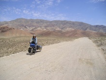
Taken at Latitude/Longitude:17.130663/-89.060376. 0.58 km West Cristo Rey Cayo Belize <a href="http://www.geonames.org/maps/google_17.130663_-89.060376.html"> (Map link)</a> IPTC: Copyright Notice kybi.sk
Date/Time Fri 16 Apr 2010 03:48:05 PM CEST IPTC: City Cristo Rey
IPTC: Country Name Belize IPTC: Province State Cayo
IPTC: Sub Location 0.58 Km West Cristo Rey

Close
Photo Coordinates: 17.130663°, -89.060376°

Photo Location Map


Powered by Gallery v2.3
Theme - X_treme
Colorpack - x_charcoal
© 2003-2016 - kybi (all rights reserved)
Powered by Gallery (http://gallery.menalto.com/) with X_treme theme(for G2.2) by Pedro Gilberto (http://www.pedrogilberto.net)