Login | Contact | Register |

Advanced Search
Show a Google Map View Slideshow View Slideshow (Fullscreen) View in Google Earth

Items Tagged: dasa

1. IMG_3513.JPG ... 38. swiss-70.jpg 39. damaged... 40. IMG_4053.JPG 41. Mexican Bay... 42. P1030697.JPG 43. Mexican Bay... 44. Dasa in the... ... 56. IMG_4974.JPG

Random Image

P1030695.JPG


Date: 18.09.2006 Views: 3896

WARNING: block core.NavigationLinks doesn't exist.

Mexican Bay coastal road

Kybi's Photo Gallery Items Tagged: dasa
 
IMG_4053.JPG
P1030697.JPG
 
FirstPrevious
NextLast
Dasa eating torta in La Magdalena Dasa on the road
swiss-70.jpg damaged coastal road - Mexican Bay
Mexican Bay coastal road Mexican Bay coastal road
Dasa in the car going back from Naachtun Dasa with boa in Belize Zoo boa in Belize Zoo
Happy Dasa with Her Bike
First ImagePrevious Page
1 2 3
Last Image
Size:
Full size: 92x92
Close

Close

Close

Photo Properties

summary  details
Aperture Value f/7.1 Focal Length 200 mm
ISO 100 Shutter Speed Value 1/500 sec
IPTC: Caption 
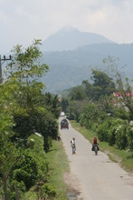
Taken at Latitude/Longitude:18.409116/-93.520032. 5.30 km South-West La Union Primera Sección Tabasco Mexico <a href="http://www.geonames.org/maps/google_18.409116_-93.520032.html"> (Map link)</a> Date/Time Fri 26 Feb 2010 04:37:01 PM CET
IPTC: City La Union Primera Sección IPTC: Country Name Mexico
IPTC: Province State Tabasco IPTC: Sub Location 5.30 Km South-West La Union Primera Sección

Close
Photo Coordinates: 18.409116°, -93.520032°

Photo Location Map


Powered by Gallery v2.3
Theme - X_treme
Colorpack - x_charcoal
© 2003-2016 - kybi (all rights reserved)
Powered by Gallery (http://gallery.menalto.com/) with X_treme theme(for G2.2) by Pedro Gilberto (http://www.pedrogilberto.net)